

C-MAP Reveal US Lakes North Central

SKU: CMAPM-NA-Y212-MS

C-MAP Reveal US Lakes North Central

$179.00

Envío y origen
  • Envíos a toda Venezuela mediante empresas de encomienda con cobertura nacional.
  • Procesamiento del pedido: 1 a 3 días hábiles tras la confirmación del pago.
  • El costo de envío se calcula al finalizar la compra. Pedidos desde $199 con envío gratis.
  • Las imágenes y especificaciones de los productos son suministradas por el fabricante.
Política de envíos y devoluciones
0 personas están viendo este producto ahora

Métodos de pago:

C-MAP Reveal US Lakes North Central

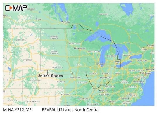
The C-MAP Reveal US Lakes North Central is a digital marine chart designed for navigation across the North Central United States. This chart provides essential information for mariners and is intended for installation in compatible chartplotters and multifunction displays.

Compatibility & Applications

  • Fits into compatible chartplotters from brands such as Garmin and Lowrance.
  • Provides detailed coverage for lakes including Michigan and Wisconsin.
  • Integrates with multifunction displays to enhance navigation capabilities.
  • Replaces older C-MAP chart versions, ensuring updated data accuracy.
  • Supports fishing, boating, and recreational navigation activities.
  • Wires to NMEA 2000 systems for real-time data updates.

The unit enhances navigation accuracy with detailed lake information and is designed for seamless installation in compatible systems. It serves as a drop-in replacement for older chart versions, ensuring mariners have access to the latest and most precise data available.

Technical Specifications

Weight 0.07 lbs
Dimensions (L × W × H) 4.00 × 6.00 × 1.00 in
Peso0.50 lbs
Dimensiones4.00 × 6.00 × 1.00 in

Descripción

C-MAP Reveal US Lakes North Central

The C-MAP Reveal US Lakes North Central is a digital marine chart designed for navigation across the North Central United States. This chart provides essential information for mariners and is intended for installation in compatible chartplotters and multifunction displays.

Compatibility & Applications

  • Fits into compatible chartplotters from brands such as Garmin and Lowrance.
  • Provides detailed coverage for lakes including Michigan and Wisconsin.
  • Integrates with multifunction displays to enhance navigation capabilities.
  • Replaces older C-MAP chart versions, ensuring updated data accuracy.
  • Supports fishing, boating, and recreational navigation activities.
  • Wires to NMEA 2000 systems for real-time data updates.

The unit enhances navigation accuracy with detailed lake information and is designed for seamless installation in compatible systems. It serves as a drop-in replacement for older chart versions, ensuring mariners have access to the latest and most precise data available.

Technical Specifications

Weight 0.07 lbs
Dimensions (L × W × H) 4.00 × 6.00 × 1.00 in

Especificaciones

Resumen

Peso0.50 lbs
Dimensiones4.00 × 6.00 × 1.00 in

Opiniones de clientes