


C-MAP Reveal – GULF OF Mexico AND Bahamas

SKU: CMAPM-NA-Y204-MS

C-MAP REVEAL – GULF OF MEXICO AND BAHAMAS

$260.00

Envío y origen
  • Envíos a toda Venezuela mediante empresas de encomienda con cobertura nacional.
  • Procesamiento del pedido: 1 a 3 días hábiles tras la confirmación del pago.
  • El costo de envío se calcula al finalizar la compra. Pedidos desde $199 con envío gratis.
  • Las imágenes y especificaciones de los productos son suministradas por el fabricante.
Política de envíos y devoluciones
0 personas están viendo este producto ahora

Métodos de pago:

C-MAP REVEAL – GULF OF MEXICO AND BAHAMAS Chart

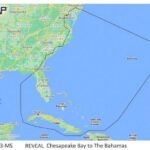
The C-MAP REVEAL – GULF OF MEXICO AND BAHAMAS is a detailed marine chart designed for Lowrance, Simrad, and B&G chartplotters, providing comprehensive mapping of the Gulf of Mexico and the Bahamas. It offers advanced features for navigation and fish finding.

Compatibility & Applications

  • Fits Lowrance, Simrad, and B&G chartplotters for easy installation.
  • Provides detailed mapping for vessels operating in the Gulf of Mexico.
  • Integrates with existing NMEA 2000 systems for enhanced navigation.
  • Supports fishing applications with clear underwater views of fish and structure.
  • Replaces older C-MAP charts for improved detail and accuracy.

This unit enhances navigation and fishing efficiency by providing precise underwater mapping and is a drop-in replacement for older C-MAP charts, ensuring users have the latest data for their marine activities.

Technical Specifications

Weight 0.07 lbs
Dimensions (L × W × H) 4.00 × 6.00 × 1.00 in
Peso0.50 lbs
Dimensiones4.00 × 6.00 × 1.00 in

Descripción

C-MAP REVEAL – GULF OF MEXICO AND BAHAMAS Chart

The C-MAP REVEAL – GULF OF MEXICO AND BAHAMAS is a detailed marine chart designed for Lowrance, Simrad, and B&G chartplotters, providing comprehensive mapping of the Gulf of Mexico and the Bahamas. It offers advanced features for navigation and fish finding.

Compatibility & Applications

  • Fits Lowrance, Simrad, and B&G chartplotters for easy installation.
  • Provides detailed mapping for vessels operating in the Gulf of Mexico.
  • Integrates with existing NMEA 2000 systems for enhanced navigation.
  • Supports fishing applications with clear underwater views of fish and structure.
  • Replaces older C-MAP charts for improved detail and accuracy.

This unit enhances navigation and fishing efficiency by providing precise underwater mapping and is a drop-in replacement for older C-MAP charts, ensuring users have the latest data for their marine activities.

Technical Specifications

Weight 0.07 lbs
Dimensions (L × W × H) 4.00 × 6.00 × 1.00 in

Especificaciones

Resumen

Peso0.50 lbs
Dimensiones4.00 × 6.00 × 1.00 in

Opiniones de clientes