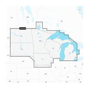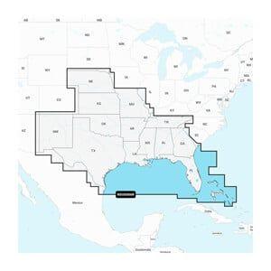

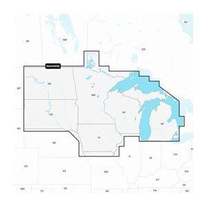

GARMIN Navionics+ U.S. North, Navionics+ microSD/SD card NAUS005R

SKU: GAR010-C1368-30

GARMIN Navionics+ U.S. North, Navionics+ microSD/SD card NAUS005R

$149.99

Envío y origen
  • Envíos a toda Venezuela mediante empresas de encomienda con cobertura nacional.
  • Procesamiento del pedido: 1 a 3 días hábiles tras la confirmación del pago.
  • El costo de envío se calcula al finalizar la compra. Pedidos desde $199 con envío gratis.
  • Las imágenes y especificaciones de los productos son suministradas por el fabricante.
Política de envíos y devoluciones
0 personas están viendo este producto ahora

Métodos de pago:

GARMIN Navionics+ U.S. North, Navionics+ microSD/SD card NAUS005R

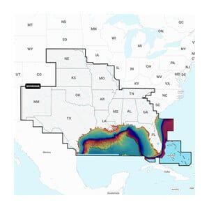
The GARMIN Navionics+ U.S. North is a microSD/SD card designed for marine navigation, providing detailed cartography for northern U.S. waters. This unit is installed in compatible GARMIN chartplotters to enhance navigation capabilities and ensure accurate route planning.

Compatibility & Applications

  • Fits GARMIN chartplotters that accept microSD/SD cards.
  • Provides detailed mapping for northern U.S. coastal and inland waters.
  • Updates navigation data daily for enhanced accuracy.
  • Replaces older Navionics+ cards for updated cartography.
  • Integrates with GARMIN devices for seamless navigation experience.
  • Mounts in chartplotters on vessels from 18 to 40 ft in length.

This unit enhances navigational accuracy with updated charts and is essential for coastal navigation in northern U.S. waters. A direct replacement for older Navionics+ models, it ensures access to the latest marine data, making it a critical tool for both recreational and professional mariners.

Technical Specifications

Weight 1.00 lbs
Dimensions (L × W × H) 2.10 × 1.50 × 0.10 in
Peso1.00 lbs
Dimensiones2.10 × 1.50 × 0.10 in
MFG#010-C1368-30
UPC821245991676

Descripción

GARMIN Navionics+ U.S. North, Navionics+ microSD/SD card NAUS005R

The GARMIN Navionics+ U.S. North is a microSD/SD card designed for marine navigation, providing detailed cartography for northern U.S. waters. This unit is installed in compatible GARMIN chartplotters to enhance navigation capabilities and ensure accurate route planning.

Compatibility & Applications

  • Fits GARMIN chartplotters that accept microSD/SD cards.
  • Provides detailed mapping for northern U.S. coastal and inland waters.
  • Updates navigation data daily for enhanced accuracy.
  • Replaces older Navionics+ cards for updated cartography.
  • Integrates with GARMIN devices for seamless navigation experience.
  • Mounts in chartplotters on vessels from 18 to 40 ft in length.

This unit enhances navigational accuracy with updated charts and is essential for coastal navigation in northern U.S. waters. A direct replacement for older Navionics+ models, it ensures access to the latest marine data, making it a critical tool for both recreational and professional mariners.

Technical Specifications

Weight 1.00 lbs
Dimensions (L × W × H) 2.10 × 1.50 × 0.10 in

Especificaciones

Resumen

Peso1.00 lbs
Dimensiones2.10 × 1.50 × 0.10 in
MFG#010-C1368-30
UPC821245991676

Opiniones de clientes