
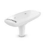
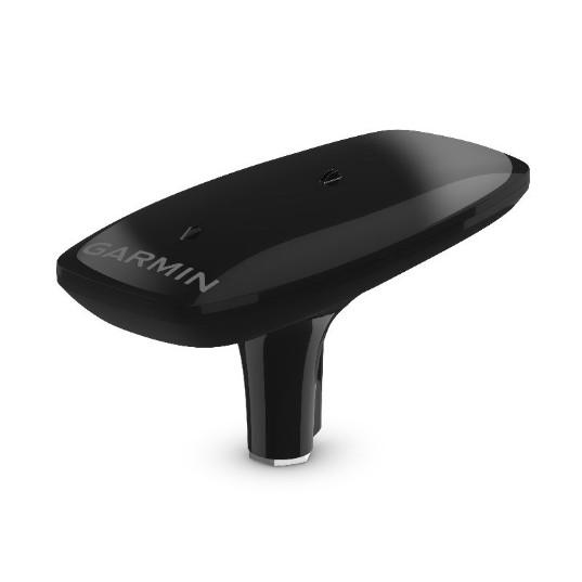

GARMIN MSC 10 Marine Satellite Compass, Heading Sensor and Multi-band GPS Receiver, Black

SKU: GARMSC10BLK

GARMIN MSC 10 Marine Satellite Compass, Heading Sensor and Multi-band GPS Receiver, Black

$1,149.99

Envío y origen
  • Envíos a toda Venezuela mediante empresas de encomienda con cobertura nacional.
  • Procesamiento del pedido: 1 a 3 días hábiles tras la confirmación del pago.
  • El costo de envío se calcula al finalizar la compra. Pedidos desde $199 con envío gratis.
  • Las imágenes y especificaciones de los productos son suministradas por el fabricante.
Política de envíos y devoluciones
0 personas están viendo este producto ahora

Métodos de pago:

Garmin MSC 10 Marine Satellite Compass, Heading Sensor and Multi-Band GPS Receiver

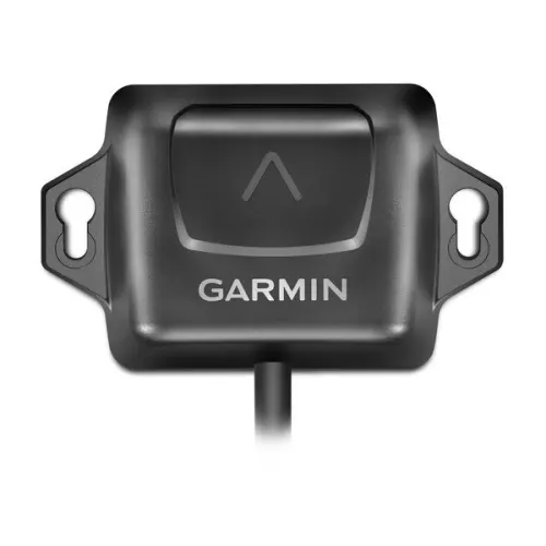
The Garmin MSC 10 is an NMEA 2000 certified marine satellite compass weighing 1.12 lbs and measuring 6 × 13 × 3 inches, built around a multi-band GNSS (L1 and L5) and multi-constellation receiver. Marine electronics technicians and vessel owners install the unit as a primary heading and position sensor for chartplotters, autopilots, and other onboard navigation systems.

Technical Specifications

Weight 1.12 lbs (0.51 kg)
Dimensions (L × W × H) 13 × 6 × 3 in (330 × 152 × 76 mm)
Color / Finish Black
GNSS Bands L1 and L5 (multi-band)
Satellite Constellations GPS, Galileo, GLONASS, BeiDou
Position Accuracy Within 1 meter
Heading Accuracy 2-degree RMS (dynamic)
Position Update Rate 10 Hz
Network Interface NMEA 2000 (certified)
Backup Heading Magnetometer-based (calibration required)

Compatibility & Applications

  • Wires directly into any existing NMEA 2000 network as a plug-and-play sensor node.
  • Pairs with Garmin GPSMAP 8400/8600 series chartplotters as a primary heading source.
  • Pairs with Garmin GPSMAP 7×3, 9×3, 12×3, 10×2, and 12×2 series chartplotters.
  • Mounts as the primary heading sensor for Garmin Reactor autopilot series installations.
  • Delivers heading, pitch, roll, and heave data to compatible Garmin chartplotters via NMEA 2000.
  • Connects to third-party NMEA 2000 displays using basic calibration mode.

The MSC 10 is NMEA 2000 certified and requires no calibration for GPS-based heading—no magnetic deviation corrections, no swinging the vessel. The built-in attitude and heading reference system (AHRS) filters GPS-derived heading at all speeds, including sharp turns and stationary conditions, distinguishing the unit from conventional fluxgate compass sensors.

Peso1.12 lbs
Dimensiones6.00 × 13.00 × 3.00 in

Descripción

Garmin MSC 10 Marine Satellite Compass, Heading Sensor and Multi-Band GPS Receiver

The Garmin MSC 10 is an NMEA 2000 certified marine satellite compass weighing 1.12 lbs and measuring 6 × 13 × 3 inches, built around a multi-band GNSS (L1 and L5) and multi-constellation receiver. Marine electronics technicians and vessel owners install the unit as a primary heading and position sensor for chartplotters, autopilots, and other onboard navigation systems.

Technical Specifications

Weight 1.12 lbs (0.51 kg)
Dimensions (L × W × H) 13 × 6 × 3 in (330 × 152 × 76 mm)
Color / Finish Black
GNSS Bands L1 and L5 (multi-band)
Satellite Constellations GPS, Galileo, GLONASS, BeiDou
Position Accuracy Within 1 meter
Heading Accuracy 2-degree RMS (dynamic)
Position Update Rate 10 Hz
Network Interface NMEA 2000 (certified)
Backup Heading Magnetometer-based (calibration required)

Compatibility & Applications

  • Wires directly into any existing NMEA 2000 network as a plug-and-play sensor node.
  • Pairs with Garmin GPSMAP 8400/8600 series chartplotters as a primary heading source.
  • Pairs with Garmin GPSMAP 7×3, 9×3, 12×3, 10×2, and 12×2 series chartplotters.
  • Mounts as the primary heading sensor for Garmin Reactor autopilot series installations.
  • Delivers heading, pitch, roll, and heave data to compatible Garmin chartplotters via NMEA 2000.
  • Connects to third-party NMEA 2000 displays using basic calibration mode.

The MSC 10 is NMEA 2000 certified and requires no calibration for GPS-based heading—no magnetic deviation corrections, no swinging the vessel. The built-in attitude and heading reference system (AHRS) filters GPS-derived heading at all speeds, including sharp turns and stationary conditions, distinguishing the unit from conventional fluxgate compass sensors.
Especificaciones

Resumen

Peso1.12 lbs
Dimensiones6.00 × 13.00 × 3.00 in

Opiniones de clientes